Paddles with an Anas acuta...... unashamedly biased toward the sea kayak of that name (actually the voyages of two boats, one 'traffic over gold', one 'quill')

Sunday 16 December 2012

Mid-December Weather

Bright sunshine as we left Southsea, dodging the 1000 Santas and Santarettes doing a charity fun run from The Pyramids. A few pursued us as far as the sea, click on the photo to see the red dots in more detail.
Crossing between the forts we saw a place not to be, between an ocean going tug and its barge, but we were well astern.
 And a rainbow, promise of good weather as we approached Ryde for lunch? The inshore forecast said 5-6, but it was 2-3. We came across a large tree awash, complete with branches and roots, and gave QHM a call on the VHF to advise shipping. We heard of its westbound progress with the tide, past the hovercraft and fast cats, past Fishbourne and the ferries and on towards Cowes throughout the afternoon on the radio.
 Then the 6 materialised in a vicious squall coming out of nowhere, but mostly from behind.
 Fun after the flat water thus far.
Back to Southsea for a bumpy atterrissage.

Monday 3 December 2012

Once again the start of winter

Winter, time for our annual forays into freshwater. Last weekend there was plenty of water.
Liz lines up for the second part of the 'Triple' on the Dart. Unexpectedly warm water, as tropical air mixing with the cold gave us torrential downpours.
 Meanwhile, how tranquil the sea can be, our own personal beam of sunshine in a wintery sky.
Not a breath of wind on the 2nd day of December as we paddle towards the entrance of Chichester Harbour and the open sea. Chilly, only 3 degrees air temperature and 5 degree water. Once into the open sea, our fingers rejoiced at the jump to 10 degree water. There was even a wave, or rather several waves, peaking here and there as their patterns crossed in the shallow waters of the West Winner. We spent sometime chasing the waves, they proved completely unpredictable. Once, just once, I happened to be in exactly the right spot and found myself surfing down a huge wave face, 5 seconds later and it had vanished again, never to reappear.

Monday 15 October 2012

KAPE boats

Yesterday, we had a chance to demo the KAPE range of boats, recently becoming available in the UK 

First up the Zephyr 480, a stable 'beginner' style boat, available with rudder or skeg, not very exciting, but then it is not meant to be. No discernible vices either.
 Then the Rapido Ski, this was a lot of fun, everyone enjoyed paddling it, here is Steve having a go. I could see myself paddling this in summer off the beach and felt very stable after a paddle across to Portchester Castle.
 The seat held you snugly. There was also a chance to try the K1 Rapido, the same hull but with a sit inside deck, with no hip or thigh grip this felt more wobbly, I preferred the ski version. For some reason we don't have any pictures, but look at the website.
 The Destroyer is something else again, it really does look like a battleship! All square shapes, barely a curve in sight. This is a new model, not even a picture on the website. The hull has something of the Angmagssalik about it, almost a square box section in the centre, but faired at the ends, chines very very sharp, more rocker than the Angmagssalik, so it turns surprisingly well. Fantastic secondary stability, it just paddles along on edge with the cockpit rim under water. Very fast. Despite the high foredeck I wasn't scrapping my knuckles. I thought that I'd hate this boat, but I have to say I enjoyed paddling it.
 I'd like a go in choppy water, and heavily loaded for an expedition. Ideal for size 12 feet, the cockpit could fit a whole family and the dog inside. This model had a skeg, out in the harbour with F2 on the stern quarter, it needed maybe 1/3 skeg, so I would guess that keeping it on course in any wind would not be a problem. But could I look at that foredeck for hours, always expecting some sort of naval rating to open the fore-hatch and scan the horizon for the enemy?


Saturday 8 September 2012

Triagoz


Next to the campsite at the CKMER 30th anniversary meeting at Ile Grande near Lannion, Brittany. No, not the artistic rock piles, click and look at the horizon. Six miles out, Triagoz was calling.

A couple of hours paddling and the tide is running fast around the submerged  plateau

The lighthouse that the tide had been carrying us down towards, not the easiest of landings, but amongst the rocks the swell had disappeared.
 Loading the boats onto the first platform clear of the sea, how deep can we stack them?
 Not deep enough, a couple of boats need to be carried to the second step.

Our lunch and siesta spot -well we had to wait for the favourable tide- that's our excuse for a doze out of the wind.
A room with a view......

What a great bivouac spot this would be..

Sunday 12 August 2012

Berwick to Pease bay

 Although the coast north from Berwick looks a bit dull on the map, with the A1 and the railway following the coast all the way. Below the cliffs it is full of interest.
One cannot leave the openings in the sandstone unexplored.
 Penetrating deep into the cliffs.
It looks as if around HW is the best time for entering the caves.
Fine arches and tunnels.
 Nearing St Abbs,
and its harbour (low water).
Delightful passages amongst the blocks of hard igneous and metamorphic rocks.


Pettico Wick one of the few easy lunch spots.
More lovely coast towards Fast Castle Head and our finish at Pease Bay.
 World class rock hoping around Fast Castle Head, the sea was almost flat so maximum up and down in the swell around 1.5m in the rocks, with a 1m swell on the sea it must be superb.
As it was, only one spot of gelcoat left behind in an unanticipated suck-dry.
This old boathouse, near the celebrated Hutton's unconformity, a place of pilgrimage for geologists, had been partially inundated by a landslide. Iain had thought of bivouacing inside in September, so the landslide was this winter. It would have been scary to be inside as the hill above slumped down. Check out Iain's post for more details of this stretch of coast.

All that remained was to fetch the car. Perrymans has an hourly bus service along this coast, nearest stop to Pease Bay; about 30 minutes walk at Cockburnspath. The buses are often late according to fellow travellers, so don't worry if it seems a bit tight to catch the bus. However, they soon make up time, the bus ride a thrill in itself. Cheaper than a single fairground ride and it lasts longer!

We camped at High View/ Drone Hill campsite with its plethora of type 27 pillboxes. Just the ticket for the pillbox enthusiast. Even for us, the top of the pillboxes was a refuge from the midges. Good views of the wind farm as well. The place has mixed reviews on the web, we can say we found it cheap, comfortable, well equipped and very friendly.

Monday 6 August 2012

Fog in the Farne Islands

A map from Wikipedia http://en.wikipedia.org/wiki/Farne_Islands This is from the 1947 OS map but is more useful than the current OS maps because it uses a lower chart datum and so shows more low tide rocks and reefs.
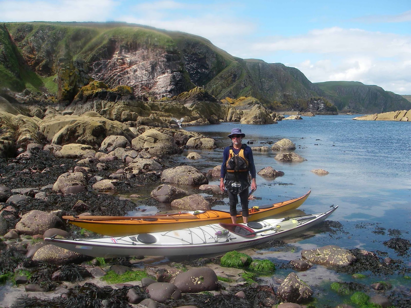
Launching from Nacker Hole, Beadnell, some 4nm south of the islands, to catch the northbound tide. The burger van in the car park around the corner opens early and the bacon and egg bap is just the ticket, we were the first customers of the day at 8.15.
 Flat calm and murky, but the islands are visible.
Paddling due north the tide carried us NW to Inner Farne. There was a back eddy along the East side and the odd small wave where the currents meet. Intending to visit all the isles,we set off for the Megstone, it seemed to be directly downtide, so we paddled straight for it. The mist came  down and we were in a white world. Keeping on our 330 degrees, we could hear seal sound ahead, then to the west, then the sound of breaking waves to the west. We followed our ears and were relieved to meet the Megstone; not visible until less than 50m away.
Extensive kelp beds to the west of the rocks deflect the tide and we could see it running due east at 2kt past the rock, the easterly set further out had pushed us off target. Thank goodness for seal song, we were pleased not to have stopped our ears, argonaut style, to avoid the siren call. Trust your compass, but use common sense as well. Our back-up plan, if no land was found in 30 minutes, of turning through 180 degrees and hoping to hit one of the larger islands wasn't needed.
Much of the rest of the day was spent on compass bearings, a 'silva type' with moving base plate and the OS map on the deck plus some guestimating of tidal flows being sufficient for on-the-water course plotting. Double checked by Liz! Once having found the small and isolated Megstone we would be unlucky to miss the larger targets of the grouped inner and outer islands. If all else failed, less than 2 hours paddling due west would bring us back to England, so we could not get very lost. A dive boat was at the Megstone doing 'diving with seals'. but the skipper had little knowledge of tidal flows, he just clicked on his gps and electronic chart and there he was.
A seal following along was often the only thing in sight, but we found The Kettle straight away by allowing for about 1kt of easterly flow between it and the Megstone. The fog was thick enough that you couldn't see Knoxes Reef from Inner Farne, only a stone's throw away. Crossing Staple Sound we allowed for between 1  and 2kt of NW bound tide. In fact we found about 1kt until Gun Rock came into view at 50m and then a strong westerly set with small standing waves to paddle through. By now the fog was lifting and we made our way around Staple, Brownsman, Wamses and Harcer to Longstone in sunshine.
After 3.5 hours paddling we were pleased to stretch our legs around the lighthouse. The planning for this trip was based on the information given by John at http://www.seakayakingnorthumberland.co.uk/
We were able to thank John himself as he was picnicing at the lighthouse with his family. That's him to the right of Liz. A party from Tynemouth joined us as well, so we were a convivial group.
As we set off the fog was coming down again. The tide had turned SE bound and we estimated 1kt average to cross Staple Sound, in fact it was less than this except for a fast stream half way across. This ended in friendly overfalls just S of the Sound, but you could see that with wind and swell against the tide it would be a spot to avoid.
The sun came out from time to time, the west and southern ends of the islands are the most picturesque, whilst the flatter slopes to north and east have all the seals. Thick fog cover prevailed all the way back to the mainland with almost zero visibility at times. We paddled on 210, 40 degrees off the 170 needed for Seahouses to allow for a knot or so of tide and to keep off the track of the pleasure boats. I saw a fishing boat about 300m away and was pleased the fog was lifting. Whilst studying the speed and course of the boat, it suddenly turned into a seagull floating 10' away on the water. Beware the human brain, hot on adding 1 and 1 to make 10. The strange thing is that it doesn't even acknowledge its errors, the boat turned  seamlessly into a seagull in front of my eyes.

We hit the mainland just right, just N of Seahouses, nearly paddling into a man in thigh deep water holding hands with his son  who was waist deep. We guessed that the beach must be nearby! The foghorn at Seahouses plus the noise of the pleasure boats had given us confidence that we were on track all the way across. The mouth of Seahouses harbour was slightly worrying, we could see all the way across (30m), but not any of the boats we could hear moving. We waited for a pleasure boat to come out of the harbour, then crossed smartly on the basis that an inbound boat would instinctively turn hard to starboard and if we paddled hard ahead we could mange to avoid a collision. A boat came in out of the fog just as we were across. Now all that remained was to find Nacker Hole -not nearly as easy as we had hoped, but eventually we were on land again, and in sunshine. The fog ended at the beach.

We had seen puffins kittiwakes, shags and seals and bits and pieces of the islands. A good reason for a return trip on a clear day.

Saturday 28 July 2012

African Wildlife on The Medway

 Nearer home, a weekend in Kent with its African wildlife,
 killer put-ins at low water,
and big ships. The Hestia Leader, 63,000 tonnes and 200m long came in ahead of us with two tugs, swung around and was pushed in sideways leaving a diminishing gap; a temptation which we didn't take!
The Westgard, 2,868 tonnes and 89m long, played tag all the way up the Swale. Pulling ahead at just above our paddling speed, then dropping back to 2kt as it waited for the bridge to lift, allowing us to overtake ahead and astern on the bends. Finally putting in a 6kt sprint to beat us under the bridge and managing to stay ahead all the way to its quay. Our efforts to keep up providing amusement for the friendly crew, who were busily sorting out the hawsers for making fast.
 The Lord Hinton, 14,200t and 155 m long, which shuttles across the North Sea with coal.
 A collection of lightships,
and the Scotline Emsland, 2,200t and 80m long with its cargo of 3,200 cu m of timber. This ship followed us all the way up into Chatham with the flood tide, not being local we were not sure where it was heading and the river was narrow. We listened on the port frequency expecting some comments about the kayakers, but radio silence, maybe we were not in the way. Eventually the flurry of activity on the timber quay indicated where it was heading for and we hurried on so it could dock. Coming back down the river with the ebb, they were busy unloading from the bow first. Shortly after, as we were taking a break at Darnet Fort, it passed us empty and bound for the sea again. A slick operation to avoid the Medway mud; alas, it was LW again by the time we landed.